Admired for its understated elegance and clarity, The London Atlas of Universal Geography Exhibiting the Physical and Political Divisions of the various countries of the World was first issued in 1834 but ran to many different versions until 1858.
It is famously difficult to accurately designate ‘editions’ of this atlas. Although for the entire life of the atlas the contents page remained unchanged, from the 1838 issue Arrowsmith often customised production, replacing and adding in extra plates to the original 50.
Contrary to the norm, it is sometimes the later ‘editions’ of the atlas that are the most valuable as they contain a great variety and number of plates. In the case of Australia, the atlas began with three plates, with later copies offering as many as eight maps.
Found on Tyneside
The copy of the Arrowsmith atlas offered by Anderson & Garland (25% buyer’s premium) in Newcastle upon Tyne on March 22 came in a full-calf binding with gilt inscription The London Atlas 1861.
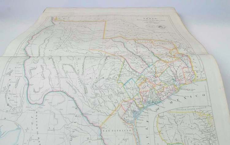
Numbering 120 double-page maps in large folio format, it included some important later additions such as a map of Texas that includes the region of the upper Rio Grande within its borders.
This influential map was published with varying differences between 1841-58 (the date of this copy) and on its own is highly desirable. Here, as part of the atlas estimated to bring £2000-3000, it took £36,000.


