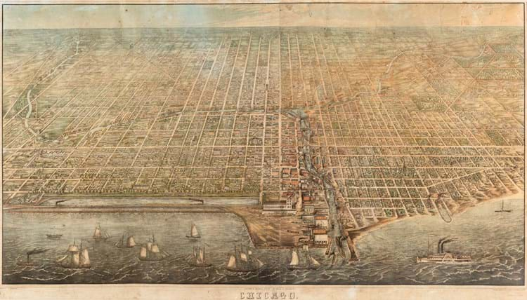
The birds-eye view of the “Windy City” dates from 1857, 14 years before the Great Chicago Fire which destroyed much of the area and left 100,000 people homeless.
The map was completed just one year after the Illinois Central Railroad was built (it appears in the foreground) and was printed by Braunhold & Sonne. It includes a lower margin legend indicating street names, homes, churches and points of industrial interest.
The example at the Leslie Hindman auction was one of only four known copies and the only one in private ownership – the three others are held by the Library of Congress, the Newberry Library and the Chicago History Museum.
Estimated at $20,000-30,000 at the auction on September 13, it was eventually sold to a Chicago collector for $198,600 (£150,115) including premium.
Director of fine books and manuscripts at Leslie Hindman, Gretchen Hause, said: “The market remains strong for rare material in excellent condition. Both of these things contributed to the high price realised for this map.”


