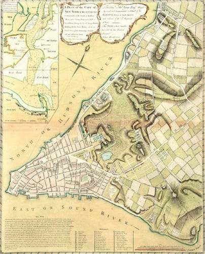
The British soldier, engineer, surveyor and mapmaker John Montressor is a name with which I am very familiar. He was the 18th century owner of Belmont, a neighbouring grand country house where I act as a guide in summer months, and in whose library I also work, so a copy of his Plan of the City of New-York & its Environs holds a personal interest for me.
Dated 1775 but actually a second issue of a map made 10 years earlier, it is among the more detailed and accurate early maps of New York and its surrounding areas published during the colonial period. It also includes an inset map of the region, incorporating parts of New Jersey, Long Island and Staten Island.
This copy sold for $26,000 (£20,155) on November 3 at Hindman (25/20/12% buyer’s premium) of Chicago.
Mighty fine
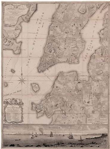
Sold for $130,000 (£104,935) at the November 3 Hindman auction, this is a 1776, second issue of a Plan of the City of New York… by Bernard Ratzer.
Much more expensive in that sale was a copy of what was once described as “the finest map of an American city and its environs produced in the 18th century”.
Bid to $130,000 (£104,935), this was a 1776, second issue of a Plan of the City of New York… by Bernard Ratzer, published in London by Jefferys & Faden and incorporating an engraved panoramic view of the city from Governors Island, after a 1760 view by a Captain Davies.
A surveyor in the British army, Ratzer was a prolific mapmaker but this is by far his most famous work. Only two or three copies of the earlier issue are recorded.
Houston in detail
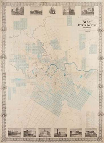
An early lithographed map of the City of Houston and its environs, compiled and drawn by Theodore Kosse and published there in 1867, which sold for $60,000 (£46,510) at Bonhams New York.
Sold for $60,000 (£46,510) by Bonhams New York (27.5/25/20/13.9% buyer's premium) on October 23 was an early lithographed map of the City of Houston and its environs, compiled and drawn by Theodore Kosse and published there in 1867 in collaboration with T Scott, a real estate broker. This large, two-sheet map measures roughly 4ft 3in x 3ft 1in (1.3m x 94cm).


