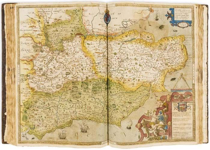
From 1570-78 the Yorkshire surveyor and cartographer Christopher Saxton (c.1540- 1610) mapped the counties of England and Wales in previously unsurpassed detail.
Financed by one of Lord Burghley’s associates, Thomas Seckford, and with government support, Saxton did the mapping himself. He used information that was already available but improved its accuracy on the ground.
This first edition by Saxton was issued in 1579, making it the earliest atlas depicting the county maps of England and Wales. Its ownership dates back to 1589, just a few years after it was made, with the inscription for Geo Cotton, most likely that of George Cotton (1560-1646), grandson of Sir George Cotton (1505-45), Sheriff of Denbighshire and courtier to Henry VIII.
It will be offered for sale at Forum Auctions in central London on July 10, estimated at £50,000-70,000.
forumauctions.co.uk or see this item on thesaleroom.com


