This was a collection described as “awe inspiring” in a brief catalogue introduction by Geir Klover, director of the Fram Museum in Oslo and author of a number of books on Norwegian polar expeditions.
There were in fact well over 400 of these “highlights” in a weighty catalogue for the December 7 sale that is likely to become a useful reference work and between them they raised almost $3m.
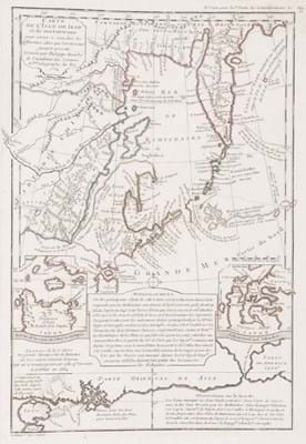
Sold at a record $85,000 (£64,435) was a 1753 first of Philippe Buache’s Considerations graphiques et physiques sur les nouvelles decouvertes au nord… A first edition of this major work on the Pacific Northwest, it was in the most desired state, with the 16 engraved maps – one above showing the peninsula and Sea of Kamchatka at the top – separately bound in atlas format.
Bering up
Vitus Bering was a Denmark-born explorer and cartographer who served in the Russian navy and undertook major expeditions in what are now the Russian and American Arctic regions of the northern Pacific, his name most famously commemorated in the Bering Straits.
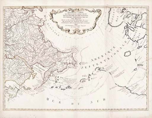
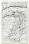
Another very successful lot was one that offered Gerhard Friedrich Müller’s first full account of the Bering expeditions, published (here with German text) by the Imperial Academy of Science in St Petersburg in the years 1758-60, together with the separately published map seen above.
According to the bibliographer of early exploration of Alaska, Valerian Lada-Mocarski, the 300-plus pages of Müller’s text are effectively an explanation of the map and a lot that combined Muller’s text with a second state, French text copy of the all important map sold at what would appear to be another record sum of $60,000 (£45,545).
Billed as a landmark of cartography and one of the more important early atlases of the American north-west, an 1824-28 St Petersburg first (French issue) of Ivan Fedorovich Krusenstern’s Atlas de l’ocean pacifique, complete with both South and North sections – something never seen at auction before – sold at $130,000 (£98,485).
The atlas contains 34 engraved maps in all, nine of which are double-page or have extension flaps.
Russian view of America
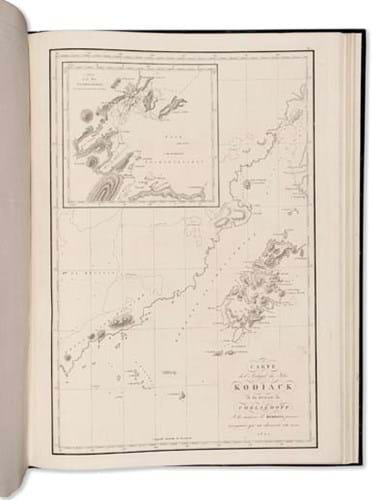
Kodiak island in Alaska, one of the 34 maps that illustrate Kruzenstern’s Atlas de l’océan pacifique. Sold for £130,000.
Sold for a treble-estimate £35,000 at Sotheby’s (25/20/12.9% buyer’s premium) on November 14 was a Russian atlas, published in St Petersburg in 1852, that features the north-west coasts of America from the Bering Strait to Cape Corrientes and the Aleutian Islands, plus the north-east coast of Asia.
It was the work of Mikhail Tebenkov, a naval officer and hydrographer who spent 25 years in Alaska and the north Pacific and was chief administrator of the Russian-American colonies.
Engraved throughout and containing a double-page general map and 33 single-page maps produced at Sitka c.1849 by Kozma Terentev, an Alaskan-Russian craftsman, this rare example was a little stained and spotted in worn but original stiff wrappers.


