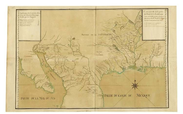
A map that resulted from J-B Bénard de la Harpe’s four-year travels in regions that we know now as Louisiana, Oklahoma, Arkansas, Texas and California, as well as parts of Mexico, it was part of a Sotheby’s (25/20/12/9% buyer’s premium) sale of June 18-28.
Valued at $120,000-180,000, it was finally knocked down at $480,000 (£369,230) to US dealer and auctioneer Graham Arader.
Prepared by the French Hydrographic Office in Paris c.1722-25 from the now lost notes and sketches produced on de la Harpe’s travels, the map measures roughly 23in x 3ft 1in (58 x 94cm) overall and is much more accurate than French printed maps of the period.
Friendly features
The cataloguer notes de la Harpe’s mapping of Galveston Island and Bay among its main inclusions, but it also features villages where Christian and friendly Indians are to be found, along with presidios, silver mines, ancient ruins and so on.
Retaining its original drab wrappers but preserved in a modern binding was a near contemporary work with a long and rambling title that takes a while to get to its key words.
Joseph Seccombe’s Business and Diversion inoffensive to God and Necessary for the Comfort and Support of Human Society. A Discourse utter’d in Part at Ammauskeeg-Falls in the Fishing-Season, 1739 was the first book on fishing printed in America – in Boston in 1743.
Once in the vast Streeter collections, it sold for $15,000 (£11,540).


