However it started, some 300 people lost their lives and an estimated 100,000 were left homeless by flames that over three days destroyed more than three square miles of the city.
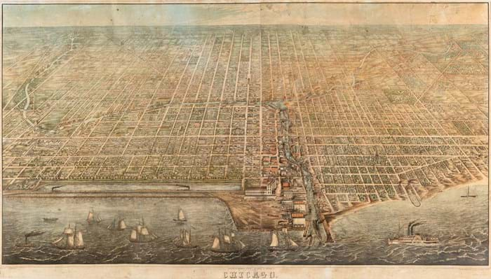
One of only four recorded copies of an exceptionally rare bird’s-eye view of Chicago as it was before the 1871 fire that destroyed so much the old city was knocked down for $160,000 (£118,520) by local auctioneers, Leslie Hindman (20/20/12% buyer’s premium) on September 15.
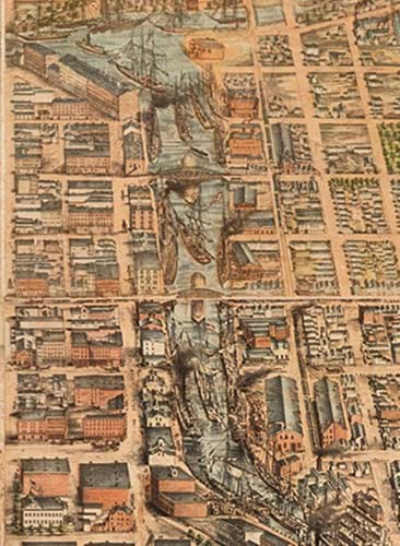
An example of the imaginative aerial views of cities produced by James T Palmatary, this four-sheet lithographed view of pre-conflagration Chicago, measuring 3ft 10in x 6ft 9in (1.17 x 2.05m) overall, was published in 1857.
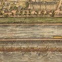
It appeared just a year after the completion of the 700 mile Illinois Central Railroad, which features prominently in the lower left section of the view, where its tracks can be seen running on trestles protected by breakwaters and dikes over a strip of land several hundred feet out in Lake Michigan.
It had originally been intended that the Illinois Central would enter Chicago from the south, but permission to lay track along the lakefront, so as to reach the city’s inner harbour, was initially refused on the grounds that the area had in 1836 been designated for public use by the Illinois & Michigan Canal Commission.
A real estate map of that era describes the area as “Public Ground - A Common to remain Forever Open, Clear, Free of Any Buildings, or Other Obstruction Whatever.”
However, after months of argument, say the auctioneers, “...the City Council granted the Illinois Central the land on Lake Michigan, which led to the northern terminus for the railroad in the old Fort Dearborn reservation.”
Visible at lower right is an area of the city known as ‘The Sands’, near present day Streeterville, which at the time was known for its high concentration of brothels, gambling dens, saloons and inexpensive rooming houses, but which in the aftermath of the fire became a point of refuge for those made homeless.
The lower margin includes a short list of notable places in the city, including Richmond House, the U.S. Marine Hospital, Grain and Freight Houses, the McCormick Reaper Factory, the ‘Illi. & Diversy’ Brewery, and the Chicago Water Works. On the view itself, street names, homes, churches and points of industrial interest are marked.
Of the three other recorded copies, one is held by the Library of Congress and the other two are in Chicago institutions, the Newberry Library and the Chicago History Museum.
This example shows some light fraying at margins as well as a few areas with light cracking or chipping and has some occasional losses filled in. There is also some minor browning or spotting, but this was not something that buyers were ever likely to get another chance to secure, as the successful US bidder will have realised.


