Though it appeared to lack one of the 15 uncoloured charts, five of which are doublepage or folding, the auctioneers could trace only two other examples in institutional collections (in the USA and Australia) and found only one record of a copy at auction – in 1937.
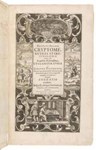
The pilot book was made at the order of Vice-Admiral Philip Affleck, C-in-C of England’s naval operations in Jamaica and Bermuda at the time, but this copy was later owned by a French master mariner, Captain Auguste Booquet. The saleroom speculated that it may have fallen into French hands during the Napoleonic wars.
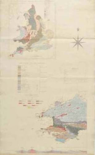
A very different map featured among a large group of geological works in the South Cerney sale.
Shown right is one of the three linen-backed and hand-coloured maps (one signed) that form part of the illustrative content of an 1839 first of Roderick Impey Murchison’s The Silurian System…, which though ex-Wigan Free Public Library with some blind-stamps to the margins, sold at £4400.
A cased and fully coloured, 1845 first (third state) of Knipe’s Geological Map of the British Isles…, sectionalised and laid on linen on four sheets, each roughly 2ft 6in x 2ft 2in (77 x 66cm), sold at £1950.
Bid to £4800 was a copy of the 1817 first and only part of William Smith’s Stratigraphical System of Organized Fossils…, a work based on the enormous fossil collection that he had sold to the British Museum in the previous year.