As well as a number of early and traditional pieces there are also some modern curios, including a world map mounted with international currency signed by footballers coming up in London. Take a look at the places represented at auction houses across the world over the coming weeks.
Kent
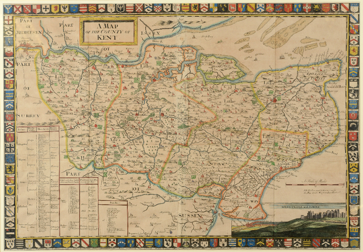
This map of the county of Kent includes a vignette of Dover Castle and ‘towne’ as well as a colourful border of the Kent family coats of arms. Measuring 56 x 80cm, it is the work of John Harris (fl.1686-1730), a British cartographer. It is offered at the Charterhouse Auctioneers & Valuers’ sale in Dorset on January 17-18, where it has an estimate of £300-500.
Scotland and Ireland
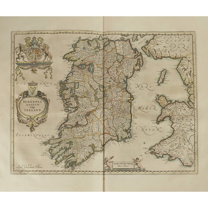
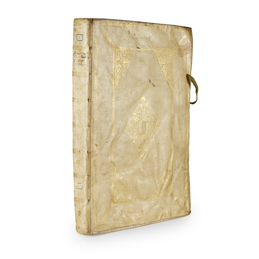
Volume five of the Theatrum Orbis Terrarum comprising Scotland and Ireland goes under the hammer in Edinburgh at Lyon & Turnbull’s sale of Books, Manuscripts, Maps & Photography
It is part of the later and larger Atlas Maior which Willem Blaeu and his son Joan worked on from around 1604 until its first publication in 1662. As a whole, it was the largest and most expensive book published in the 17th century.
Joan worked on this volume with the English cartographer John Speed, publishing it in 1654. The folio, offered on January 31, has a hand-coloured engraved title with 55 hand-coloured engraved maps. It includes an inscription at the head of the title Don de Mr Rod Piguet à Nyon and a library stamp of the Société du Musée de Nyon. It has an estimate of £4000-6000.
Europe
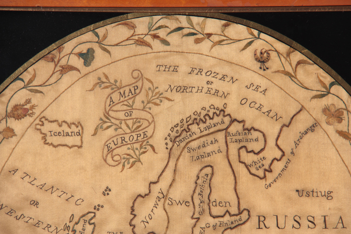
Hutchinson Scott offers an early 19th century silkwork map of Europe from c.1800 in its sale of January 24-26, where it has an estimate of £200-300. It is offered in a glazed birdseye maple moulded frame measuring 50cm high.
Nautical chart of Europe

Further afield, a rare 11th century Portolan chart on vellum are offered by the Il Ponte auction house in a sale of books and manuscripts in Milan on January 22.
The previously unknown, decorated and illuminated chart on vellum measures 2ft 7in x 3ft 3in (80cm x 1m) and was pasted onto wood sometime in the 1970s. It is attributed to the circle of Vesconte Maggiolo, the most important 16th century cartographer from Genoa.
The nautical chart shows Europe, north Africa, the Atlantic Ocean with the Canary Islands and the northern lands of Iceland, Sweden and Norway. The estimate is €50,000-80,000.
‘Tennassee’
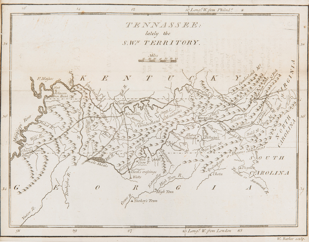
Case Antiques in Knoxville, Tennessee, offers a number of maps in its Historic Winter Fine Art and Antiques Auction on January 26. These include a map engraved by William Barker and published by Matthew Carey of Philadelphia in 1796 titled Tennassee: Lately the SWn Territory. It include the surrounding states with early cities and towns and is part of Carey’s American Pocket Atlas. It has an estimate of $1000-12000.
Currency – and footballers – of the world

One of the more unusual maps going under the hammer this month a framed and glazed map of the world, mounted with international currency signed by famous footballers from across the globe. Pele, Johan Cruyff, George Best, Kenny Dalglish and Ruud Gullit are among those represented with photographs alongside each signed note. Offered with an estimate of £300-500, it is part of Criterion Auctioneers’ weekly sale on January 14.
Airline routes
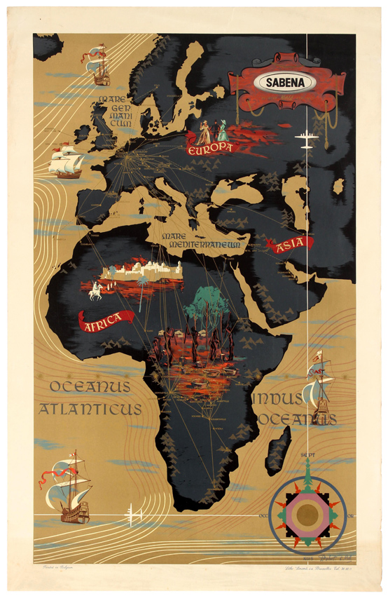
Antikbar’s Original Vintage Posters Winter Sale includes this original Sabena travel advertising poster, which features a map of Europe and Africa designed by Dohet C Pub. Published in the 1950s and offered in good condition, it has an estimate of £300-450.
The map shows the airline’s routes around the world, marking various places with scenes of local people in traditional clothing, sport activities, boats and ships at sea, farming, animals, mythical figures and airplanes overhead.